Presidio San Agustín del Tucson
Marker:
Presidio Real de San Agustín del Tucson
Location:
Agustín del Tucson Museum.
Presidio San Agustín del Tucson Museum
196 N. Court Avenue
Tucson, Pima County, Arizona
32.224420, -110.973556
Historical Significance:
In 1775, the Presidio Real de San Agustín del Tucson was established by Regular Spanish Army Lieutenant Colonel Hugo O’Conor. The fort was small and poorly constructed. After a large Apache assault in 1782, an 8- to 12-foot high adobe wall was constructed approximately 700 feet long on each side. The fort was continually updated until it reached its maximum size of 11 acres. Tucson was one of the largest frontier presidios. The Presidio was used until the Americans entered Tucson in March 1856.
DAR Historical Markers:
Eight historical markers were placed in downtown Tucson during the 1920s and 1930s as members of the Tucson Chapter, NSDAR, were concerned about the preservation of the historic Presidio San Agustín del Tucson. Two of the markers were lost, but other markers now document these historic locations. All of the markers were donated to the city when they were dedicated.
This page describes markers located at the four corners of the Presidio:
Northeast corner
Southeast corner
Northwest corner
Southwest corner
Other pages within this website describe the Plaza del las Armas and the Old Walled City Gateway.
Links:
National Park Service
Northeast Corner
Marker:
Northeast Corner Adobe Wall of Spanish Presidio of Tucson
Location:
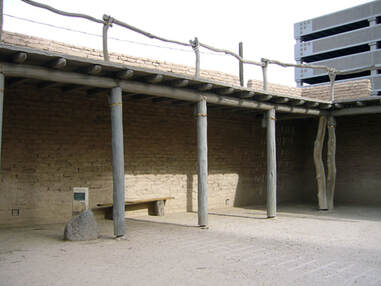
Northeast corner of Washington Street and Church Avenue inside the recreated northeast corner of the Presidio San Agustin del Tucson Museum.
Presidio San Agustin del Tucson Museum
196 N. Court Avenue
Tucson, Pima County, Arizona
Note:
To see this marker you must pay admission and go inside the museum. Visit the museum website for information regarding pricing and hours.
Historical Significance:
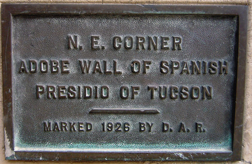
“N. E. Corner Adobe Wall of Spanish Presidio of Tucson Marked 1926 by D.A.R.”
The marker was dedicated on March 26, 1926, and placed as close to the original site as possible. Over the years a parking lot was built close to the marker. In 1976 as part of the U.S. bicentennial celebration, photographs were taken that show the marker was still in its original location.
By 1995, when the Tucson Chapter, NSDAR, celebrated its 80th birthday, the marker had disappeared. Norma Niblett, a member of the El Presidio Chapter, NSDAR, found the cornerstone marker in 2007 in the basement of the Tucson Historical Society, still attached to concrete and metal rods.
The corner stone was still missing in 2006 when the parking lot was excavated, and an historic park was built recreating the northeast corner of the Presidio San Agustin del Tucson. This park was funded by the City of Tucson’s Rio Nuevo District. The excavation identified the exact corner of the original wall, and members of the Tucson Chapter, NSDAR, and other DAR visitors from Arizona rededicated the northeast cornerstone marker March 20, 2008. The marker now identifies the exact location of the northeast corner adobe wall of the Presidio. A photograph of the cornerstone marker is published in the book Presidio San Agustin del Tucson: A View of Early Tucson that can be purchased in the gift shop at the museum.
Dedicated:
March 26,1926
Rededicated:
March 20, 2008
Sponsor:
Tucson Chapter, NSDAR
Southeast Corner
Marker:
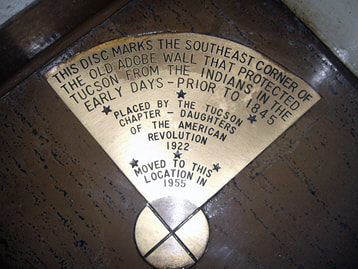
Southeast Corner – Tucson Old Walled City
Location:
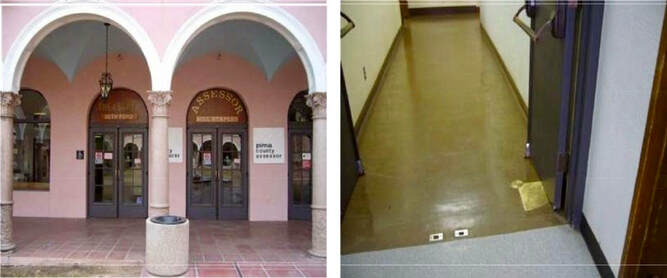
Floor of the old County Assessor’s Office
Tucson, Pima County, Arizona
Note:
This building is currently under construction until 2020. The plan is for the marker to be moved to a more accessible location. Watch this site for updated information.
Historical Significance:
“This disc marks the southeast corner of the old adobe wall that protected Tucson from the Indians in the early days – prior to 1845”
The marker was place on November 11, 1922, to represent the southeast corner of the Old Adobe Wall of the Presidio. Mabel Moffitt, Chapter Regent (1922-1926), was probably responsible for placing most of the markers according to Tucson Chapter, NSDAR, history.
The original marker was an engraved stone boulder with the inscription, “This tablet marks the site of the southeast corner of the Old Adobe Wall that protected Tucson from the Indians in the early days prior to 1845.” The stone monument was moved on October 23, 1930, due to construction. The original marker was lost. In 1955, the Tucson Chapter, NSDAR, replaced the marker with a brass quarter-circle disc marking the southeast corner. The disc was embedded in the floor of the old Pima County Assessor’s Office.
Dedicated:
1922
Rededicated:
1955
Sponsor:
Tucson Chapter, NSDAR
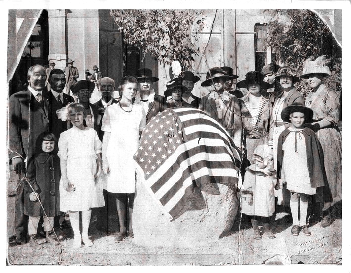
This photo was provided to Sandy Lawford, Past Regent, El Presidio Chapter, NSDAR, from Mark Still. His notes from the photo are: “Elizabeth Carter Still unveiling the cornerstone of the southeast corner of an old adobe wall which protected Tucson from the Indians in the early days. Tablet erected by the Tucson Chapter of the D.A.R. Nov. 11, 1922”
“Front row, third from left [taller of the 2 girls in white] Elizabeth Carter Still; behind ECS on the right (the lady with a hat) is her mother Lyde McKeand Still, a charter member of Tucson of DAR and one of it’s [sic] early Regents.”
Northwest Corner
Marker:
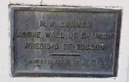
Northwest Corner – Old Adobe Wall
Location:
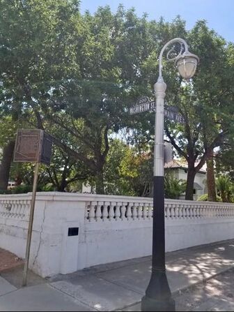
Corner of Main Avenue and Washington Street
Tucson, Pima County, Arizona
Historical Significance:
“N.W. Corner Adobe Wall of Spanish Presidio of Tucson Marked 1926 by D.A.R.”
The marker was dedicated on March 26, 1926, during the DAR State Conference held in Tucson. The marker is a ten‑inch bronze plaque embedded in the block wall surrounding the J. Knox Corbett House at the corner of Washington Street and Main Avenue.
Dedicated:
March 26, 1926
Sponsor:
Tucson Chapter, NSDAR
Southwest Corner
Marker:
Southwest Corner – Old Adobe Wall
Location:
NW corner of City Hall Parking Lot (255 W. Alameda Parking lot in rear of building)
Tucson, Pima County, Arizona
Note:
The original marker was replaced by the Tucson Historical Society in 1988. The marker is affixed to remnants of the Old Adobe Wall in front of City Hall next to the parking lot.
Historical Significance:
“S.W. Corner Adobe Wall of Spanish Presidio of Tucson Marked 1926 by D.A.R.”
The marker was dedicated on March 26, 1926, the same time as the northeast and northwest cornerstone markers. All three of the markers were identical bronze plaques less than 10-inches wide.
The bronze southwest cornerstone marker was placed on the Orndorff Hotel, but it was lost in 1935 when the hotel was demolished to build a parking lot. The hotel was originally built in 1856 and named the Phillips House for its owner.
Sam Hughes purchased the hotel from Mr. Phillips, renaming it the Cosmopolitan, and in 1896 sold it to Mrs. A. C. Orndorff. Wood reclaimed
from the hotel demolition was used to make both the Tucson Chapter, NSDAR, gavel and the Arizona State Regent’s Gavel, a gift from the Tucson Chapter, NSDAR.
Dedicated:
March 26, 1926
Sponsor:
Tucson Chapter, NSDAR
Plaza De Las Armas
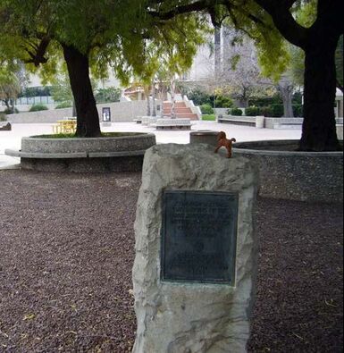
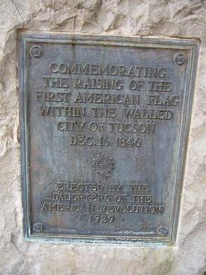
Commemorative Raising of First American Flag within Walls of Tucson
Marker:
Raising the First American Flag within Tucson Presidio December 16, 1846
Location:
El Presidio Park
Tucson, Pima County, Arizona
Historical Significance:
Tucson was under Spanish rule in 1846 which predates the Gadsden Purchase in 1853 by seven years. Raising the flag of the United States of America was a rebellious act.
Dedicated:
1929
Sponsor:
Arizona State Society DAR, Mabel Wakefield Moffitt, State Regent
Old Walled City Gateway
Marker:
Old Walled City Gateway Marker
Location:
La Placita Park
Also known as El Presidio Park
110 S Church Street
Tucson, Pima County, Arizona
Historical Significance:
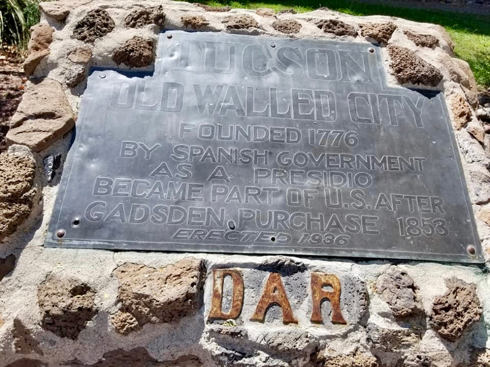
“Tucson Old Walled City Founded 1776 by Spanish Government as a Presidio / Became Part of U.S. after Gadsden Purchase 1853 / Erected 1936”
This marker commemorated the south entrance to the Old Walled City of Tucson, the largest city in the Gadsden Purchase.
Dedicated:
January 16, 1937
Sponsor:
Tucson Chapter, NSDAR
